
Chemical

Biological

Radiological

Nuclear

Explosive


Chemical

Biological

Radiological

Nuclear

Explosive

Leverage your data for geo collaboration, intelligence and situational awareness.

Visual and analytical tool to identify hotspots and trends to take protective and mitigative actions.

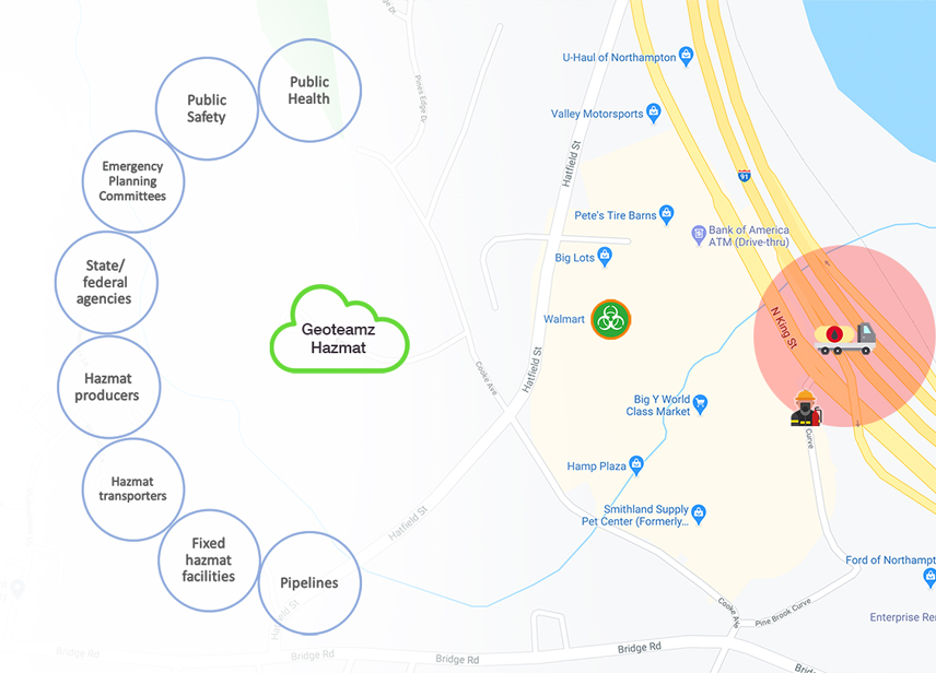
Geoteamz Hazmat’s architecture interconnects major hazmat stakeholders such as hazmat producers, transporters and storage sites to public safety organizations and emergency planning committees. When a hazmat facility maps their chemicals, that information is automatically available to local agencies. This fulfills some of the annual reporting requirements by the facilities and eliminates double entry by the agencies along with the associated errors and duplicate efforts. In Geoteamz Hazmat information is entered only once and appropriately shared with those who need it.
When integrated with Geoteamz City, hazmat location information is available to first responders who need it. When a spill occurs, first responders can immediately be notified manually through 911 calls and IoT buttons or automatically through CBRNE sensors.
Geoteamz Hazmat is available only to government organizations such as cities, counties, states and federal agencies. If your jurisdiction is interested in getting a subscription, please fill in the form below.